Vintage Map of Ireland 1862 Poster
Posted By David Paul on at Dreamgifts
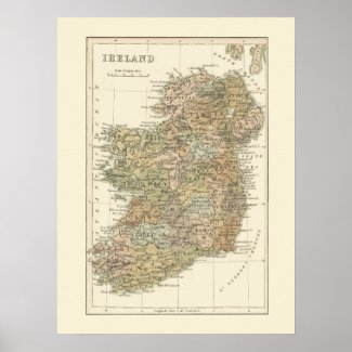
This poster features a beautiful color map of Ireland from the year 1862. The map shows the former names of County Offaly as Kings County, and County Laois as Queens County with Maryborough (now Portlaoise) as the county town. Kingstown, shown on the map about 10km south of Dublin was renamed Dun Laoghaire in 1920. Closeup of part of the map
View and Buy this product, designed by digitaldreambuilder. Browse and shop for more gifts designed by digitaldreambuilder
View and Buy this product, designed by digitaldreambuilder. Browse and shop for more gifts designed by digitaldreambuilder